Seeing into permanently shadowed regions on the Moon for the first time using machine learning

As part of NASA’s Frontier Development Lab, we developed an AI algorithm which enhanced images of permanently shadowed regions on the Moon, allowing us to see into these extremely dark regions with high resolution for the first time.
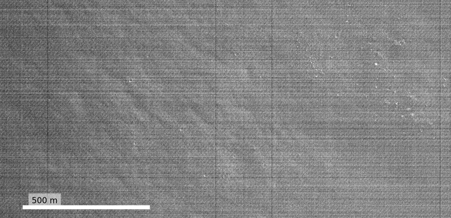
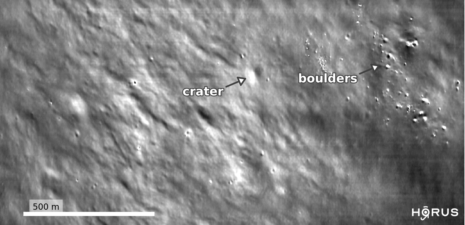
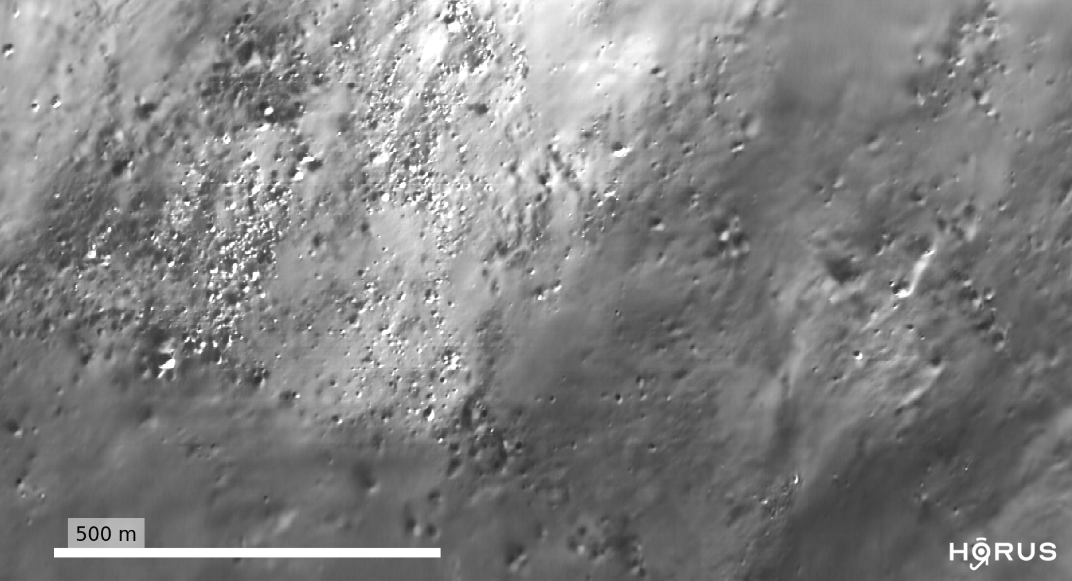
Contrast-adjusted image of a permanently shadowed region (PSR) on the Moon before / after applying our AI denoising algorithm, called HORUS. For the first time, HORUS is able to see features inside the PSR such as craters and boulders down to 3-5 meters in size. Raw image credits to LROC/GSFC/ASU. Location: Kocher crater (lunar south pole).

What is a permanently shadowed region?

Whilst sunlight reaches the majority of the lunar surface, there are some places on the Moon which are covered in permanent darkness. These are called Permanently Shadowed Regions (PSRs) and they are located inside craters and other topographical depressions around the lunar poles.

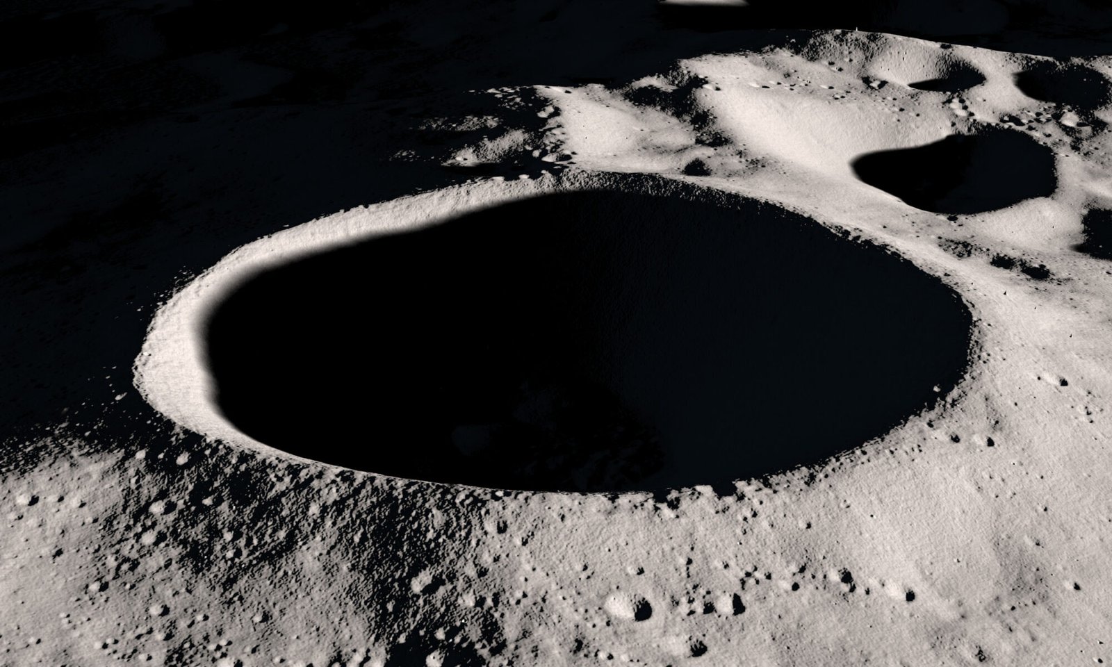
At these high latitudes, and because of their shape, no direct sunlight is able to enter PSRs. An example is the Shackleton crater at the lunar south pole (shown in this post’s feature image).

Permanently shadowed regions are amongst the coldest places in the solar system, with temperatures reaching below minus 200 degrees Celsius (minus 330 Fahrenheit, or close to absolute zero). Because of these extreme conditions, PSRs have been mostly unexplored to date.
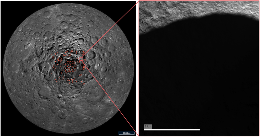
Left: Map of the Moon’s south pole, showing the location of Permanently Shadowed Regions (PSRs) (orange polygons).
Right: Lunar Reconnaissance Orbiter Narrow Angle Camera image of the Wapowski crater, which hosts a PSR. To see into the shadowed region, we first have to dramatically adjust the contrast of the image.
Image credits: LROC/GSFC/ASU/QuickMap
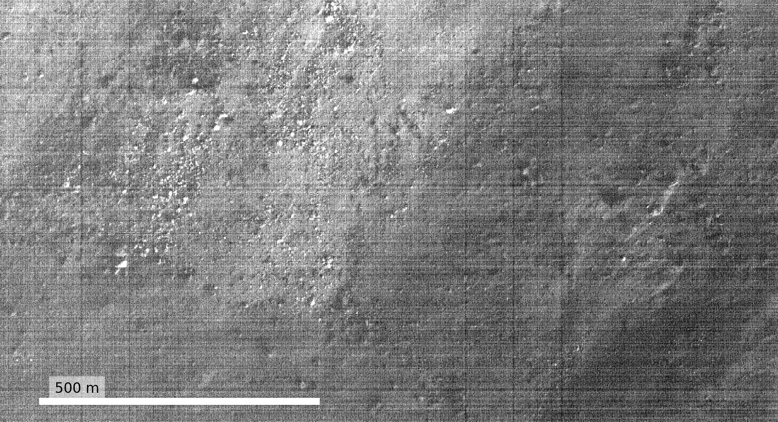
Contrast-adjusted image of the permanently shadowed region inside the Wapowski crater (lunar south pole) before / after applying HORUS. Raw image credits to LROC/GSFC/ASU

Searching for water

Whilst being enigmatic, PSRs are prime targets for science and exploration missions. We think they could trap water in the form of ice, which is essential for sustaining our presence on the Moon. Multiple missions are planned to study PSRs in the future; for example NASA’s VIPER rover will be driving into a PSR to search for water in 2023.

The problem is, because of their darkness, it is very difficult to see what PSRs contain. This makes it very hard to plan rover and human traverses into these regions, or to directly identify water inside of them.

Seeing in the dark

It turns out that PSRs are not completely dark. Whilst they do not receive direct sunlight, extremely small amounts of sunlight can enter PSRs by being scattered from their surroundings. Thus, we can still take photographs of PSRs, but these images usually have very poor quality.

Just like when you take a picture at night on your mobile phone, current state-of-the-art high resolution satellite images from the Lunar Reconnaissance Orbiter Narrow Angle Camera of PSRs are grainy and full of noise and this stops us making any meaningful scientific observations.

Fundamentally, this is because of the very low numbers of photons arriving at the camera. In this extreme, low-light regime, photons arrive with a large amount of randomness, producing the “graininess” in the image, and noise artefacts from the camera itself also dominate the images.

Night vision on the Moon: enhancing images of PSRs with machine learning

To overcome this problem, we used machine learning to remove the noise in these images. Our algorithm consists of two deep neural networks which target different noise components in the images. The first network removes noise generated by the camera, whilst the second network targets photon noise and any other residual noise sources in the images.

To help our algorithm learn, we developed a physical noise model of the camera and used it generate realistic training data. We also used real noise samples from calibration images, as well as 3D ray tracing of PSRs to inform our training. We named our approach HORUS, or Hyper Effective nOise Removal U-Net Software.
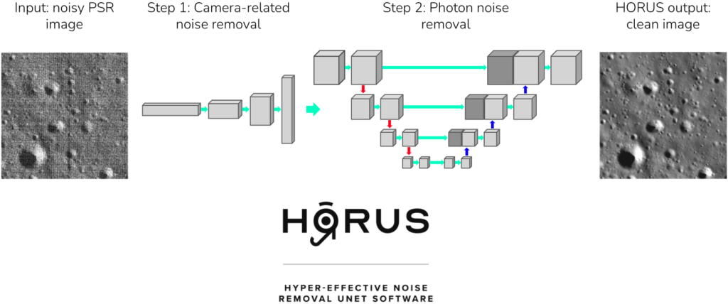
The HORUS noise removal software. Raw images of PSRs are very noisy (left hand side), and we used two deep neural networks to remove camera-related and photon noise from these images, producing clean images as output (right hand side).

The interactive sliders in this post show images of PSRs before and after applying HORUS. We find HORUS is able to remove large amounts of noise from these images, significantly improving their quality. Smaller craters, boulders and other geological features are revealed, making the scientific analysis and interpretation of these regions much easier.

What’s the impact?

With more analysis, our work could potentially pave the way for the direct detection of water ice or related surface features in these regions. It could also inform future rover and human scouting missions, allowing us to plan traverses into PSRs with more certainty. Our goal is to significantly impact humanity’s exploration of the Moon, helping to enable a sustainable, long term presence on the Moon and beyond.

Read the full CVPR 2021 paper here.

The team: Ben Moseley, Valentin Bickel, Ignacio Lopez-Francos, Loveneesh Rana

Our mentors: Miguel Olivares-Mendez, Dennis Wingo, Allison Zuniga

Other contributors: Nuno Subtil, Eugene D’Eon

Thanks to Leo Silverberg for designing the awesome HORUS logo.

Feature image credits: NASA’s Scientific Visualization Studio
+8

We used AI to search for resources on the Moon

As part of NASA’s 2019 Frontier Development Lab, we used AI to search for resources on the surface of the Moon which could one day help humans settle there.

The Moon is a mysterious place that most of us have only seen through the lens of a telescope, but with companies like SpaceX offering commercial space flights, NASA’s new plans to put humans back on the Moon by 2024 and talk of a growing lunar economy it may start to feel much closer in the future.

Finding resources on the surface is a key part of building permanent lunar bases and sustaining our presence there.

The difficulty is that we are unsure where these resources are. Part of the problem is that the majority of the Moon is unexplored; there is a large amount of satellite data covering the surface, but without the presence of ground truth observations (i.e. humans or probes actually going there) we are not entirely confident which parts of this data correspond to resources.

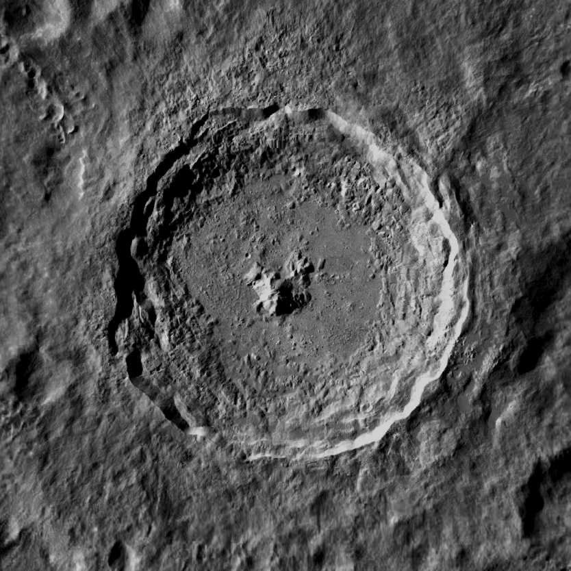
Fig. 1: Optical image of the Tycho crater (approximately 120 km across). Credit: Lunar Reconnaissance Orbiter Camera

Locating metal

An important resource is metal, and one place we might expect to find it is around the Moon’s craters. We know that some of the asteroids which have impacted the Moon would have been metallic and so it is likely they left deposits in these areas.

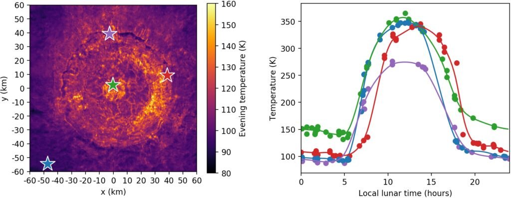
Their temperature may be a key way to detect them. The Moon is heated by the Sun during the day and cools during the evening. Just like when you recoil from your car seatbelt in the summer because it is too hot to touch, metals are excellent at retaining their heat and we expect these craters to be hotter in the evening compared to their surroundings.

Fig. 2: Evening temperatures around the Tycho crater (left) and some examples of the temperature variation over the lunar day at different locations in and around the crater (right). Taken from the DIVINER instrument.

The DIVINER instrument aboard the Lunar Reconnaissance Orbiter has recorded the surface temperature of the Moon over 10+ years, however understanding whether a temperature anomaly relates to metal is difficult because there are many factors of variation on the lunar surface which can affect its temperature. One example is the albedo of the surface, or how reflective it is, which can affect how much heat it absorbs.

Unsupervised machine learning

We used a fully data-driven, unsupervised machine learning approach to disentangle these factors of variation in the surface temperature and uncover those which may relate to metals. We trained a variational autoencoder (VAE) to reconstruct examples of the surface temperature variation over the lunar day and then looked inside its hidden representation to understand what it found were the major factors of variation.

Fig. 3: New anomaly maps generated by our AI. Our VAE found 4 main factors of variation in the temperature variations; the plots in the bottom row show what each factor responds to in an input temperature profile and the left two columns show maps of the VAE’s latent value for each factor. We see the AI is able to disentangle the effect of albedo (latent variable 2), onset of radiation time (latent variable 1) and potentially changes in thermal conductivity relating to metal (latent variable 3).

We found that the VAE could disentangle different physical effects, such as the onset time of radiation and the albedo, allowing us to isolate and map those areas which potentially have high thermal conductivity relating to metals. Fig. 3 shows anomaly maps creating using our VAE which potentially locates metallic-like signatures over the Tycho crater.

Conclusion

Our AI-generated maps could help future mission planners and progress our vision of a fully data-driven approach to space exploration. See our final presentation below for more information!

Read the full NeurIPS 2019 workshop paper here:
https://ml4physicalsciences.github.io/2019/files/NeurIPS_ML4PS_2019_115.pdf

The team: Ben Moseley, Valentin Bickel, Jérôme Burelbach, Nicole Relatores, Daniel Angerhausen, Frank Soboczenski and Dennis Wingo

+6